Current patterns of land use, the type and extent of land cover and existing land degradation are essential information for land use planning and developing appropriate land management strategies.
Mapping these features has relied heavily on extensive field investigation with remote sensing used to extrapolate field observations and enhance land mapping. Visual airphoto interpretation has been used for this purpose for decades.
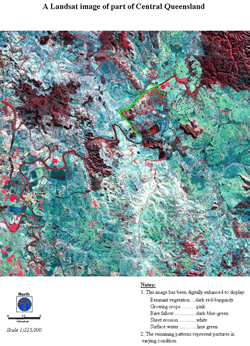
The rapid improvement in remote sensing software combined with an increased range and reduced price of available satellite imagery has enabled digital analysis of satellite imagery to become a cost-effective means of remote sensing.
Remote sensing using satellite imagery can be used to classify land cover, surface soil properties and land degradation, and for monitoring changes in land condition over time. Current land use patterns can be constructed from the land cover classifications.
The combination of digital remote sensing and terrain modelling has vastly improved land and soil assessment and greatly improved land use planning. However, like all mapping and classification tools, their accuracy and reliability is governed by the quality of the input data and the adequacy and quality of field checking.