Landform description and classification provides a basis for extrapolating point obervations to the surrounding landscape and for analysing other land resource and land use patterns.
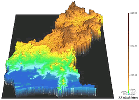
Digital terrain modelling with specialist computer software has enabled more detailed and complex analysis. Land resource and land use patterns can be assessed in a three-dimensional landscape. Detailed relationships between topographic position, specific land resource properties and land use patterns are more readily identified and more accurately mapped.
Spatial models that integrate landform, soils, vegetation and land use can be used to predict landscape changes in water movement, nutrients and salinity. These models can be applied across a three-dimensional catchment or in an individual farm mode that accounts for actual on-farm practices and constraints.
The combination of and terrain and spatial modelling with digital remote sensing has vastly improved land and soil assessment and greatly improved land use planning. However, like all mapping and classification tools, their accuracy and reliability is governed by the quality of the input data and the adequacy and quality of field checking.