SURFACE AND
GROUNDWATER IMPACT ANALYSIS
A change in
land use or land management practices can affect catchment hydrology and impact
upon receiving waters both above and the below surface. Receiving water impacts
can include an alteration to:
|
● |
inflow and outflow rates |
|
● |
sedimentation |
|
● |
nutrient levels, salinity and presence of
toxic materials |
|
● |
debris and other gross |
|
● |
pollutants. |
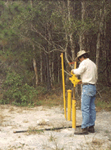
Computer
based modelling of landscape processes is being increasingly used to assess the
potential performance of a catchment or production area under a range of land
use scenarios. The accuracy and reliability of any modelling depends upon the
quality of the input data, the accuracy of the model assumptions and
simulations and the availability of field data to verify the results.
Model
predictions and other data collected during an impact assessment phase are used
to prepare an Environmental Management Plan (
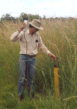
Monitoring
enables actual impacts arising from a specific land use scenario to be compared
against the model predictions and acceptable community standards. If the actual
impacts exceed prescribed standards, contingency management plans need to be
initiated to bring performance back to within acceptable levels.