Logan Albert River
In this study LRAM initially ground-truthed soil erosion and salinity in the catchments of the Logan and Albert Rivers. Data from this ground-truthing was then used to develop salinity and erosion models based on geology, landform and land use. The models were in turn used to map the distribution of both forms of degradation, as well as intensity.
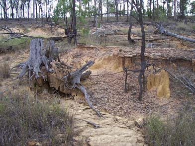
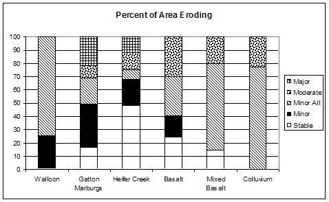
The areas exporting major amount of sediments are the Gatton and Heifer Creek members of the Marburg Formation. These members have mostly sandstone geology and largely infertile sodic duplex soils where sheet and gully erosion dominates with high frequency of bare areas. The Basalts also have significant areas eroding at moderate levels.
The project then prioritized strategies for intervention covering both
public land assets (roads and waterways) as well as the private freehold lands.
The major limitations of previous assessments were that whilst the broad
distribution was able to be identified, there was insufficient information
about the biophysical and socioeconomic controls to allow interventions to be
properly designed and targeted.