Richmond Irrigation Study
The Queensland Government released an Information Report and requested public submissions prior to preparing a Draft Water Resource Plan for the Gulf. The Information Report included an overview of irrigation potential that stated land within 10-km of the Flinders River downstream of Richmond has "low potential for agricultural development".
LRAM has conducted licence negotiations with relevant government agencies on behalf of Isis Shire Council and has designed an effluent irrigation system for the agreed disposal site.
Richmond Shire Council commissioned LRAM to independently assess irrigation potential along the Flinders River downstream of Richmond, specifically for an area that could be irrigated from a proposed off-stream storage on O'Connell Creek.
Specific objectives of the study were to:
- collect sufficient land resource information to adequately describe and map the soil landscapes at a level that could be reliably used to determine agricultural potential;
- undertake a land suitability assessment of the soil landscapes for a range of crops that could be irrigated in the area;
- identify any significant potential (land-based) environmental impacts that would be associated with irrigation development; and
- determine the likely severity of these impacts and whether management techniques are available to mitigate or control these impacts.
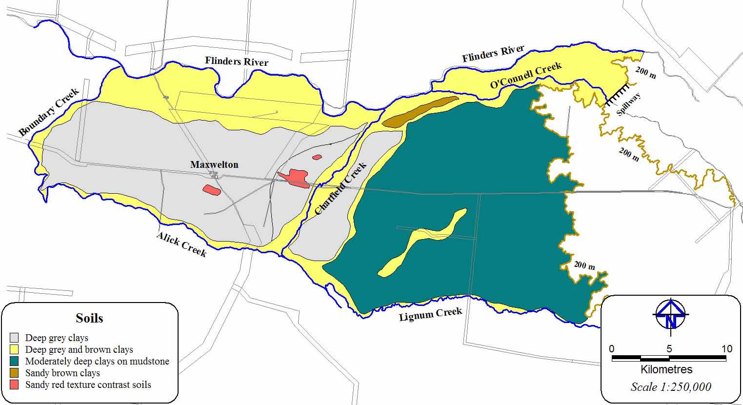
Six soils were identified and mapped at a scale of 1:250,000. Three major soils occupy 99% of the area. These cracking clays have a uniform clay texture throughout the profile and develop vertical cracks when dry. Two minor soils that were mapped comprise uniform sandy clays that do not crack when dry and texture contrast soils with a sandy loam surface abruptly overlying sandy clay subsoil. One soil occupied small, isolated areas and could not be mapped separately.
Soil distribution downstream of Richmond
A total 41,650 ha of suitable land within the potential irrigation area would be available for irrigated cropping. The available land could be used to grow irrigated cotton, forage crops, sown pastures or small crops.
The preferred option for the proposed off-stream storage on O'Connell Creek could be used to irrigate between 4,500 and 7,400 ha. There is clearly much more suitable land available for irrigated cropping within the potential irrigation area than the proposed scheme could supply.
Back