Darra to Springfield
Transport
infrastructure within the corridor is being upgraded to provide a four lane
highway connection and a new rail line. Soil information was required on the
range of soils, their distribution and characteristics to assist engineering
and environmental staff with planning and implementing landscaping and
revegetation works and with erosion control both during and after construction.
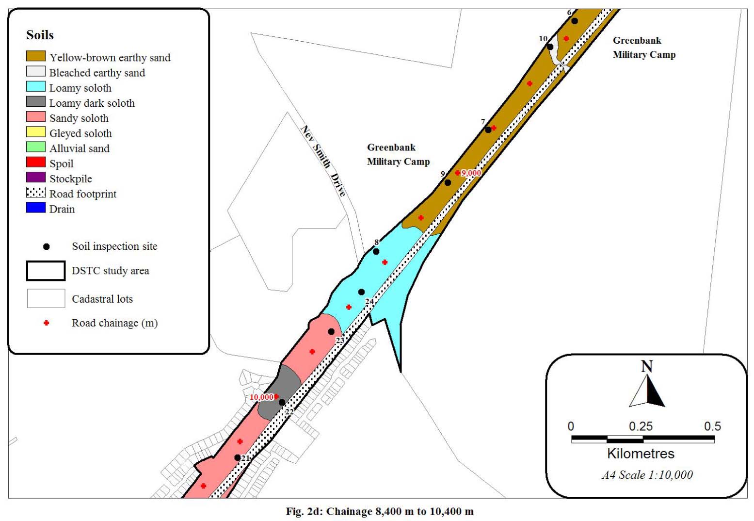
A survey of
the top 1 m of soil was undertaken to map the soil distribution within the
major part of the corridor at a scale of 1: 10,000.
The soil
survey information was used to determine:
|
● |
recommended
clearing and grubbing operations; |
|
● |
soil
erodibility and permeability; |
|
● |
recommendations
for erosion and sediment control works; and |
|
● |
suitability of soil layers for landscaping and
revegetation. |
Inherent soil
erodibility ratings were assigned to each soil using site and soil profile
conditions observed during field inspection, soil texture and the specific soil
analyses. Soil permeability ratings were also
assigned to each soil based on field evidence and soil analytical results.
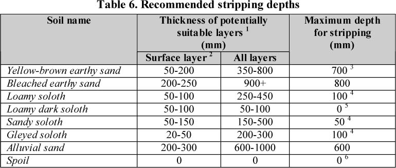
The depth of
soil material suitable for stripping, stockpiling, amelioration and subsequent
revegetation was determined by physical attributes such as texture and
potential for dispersion.
Implications
for clearing and grubbing operations and erosion control and sedimentation
works were also discussed in the report.