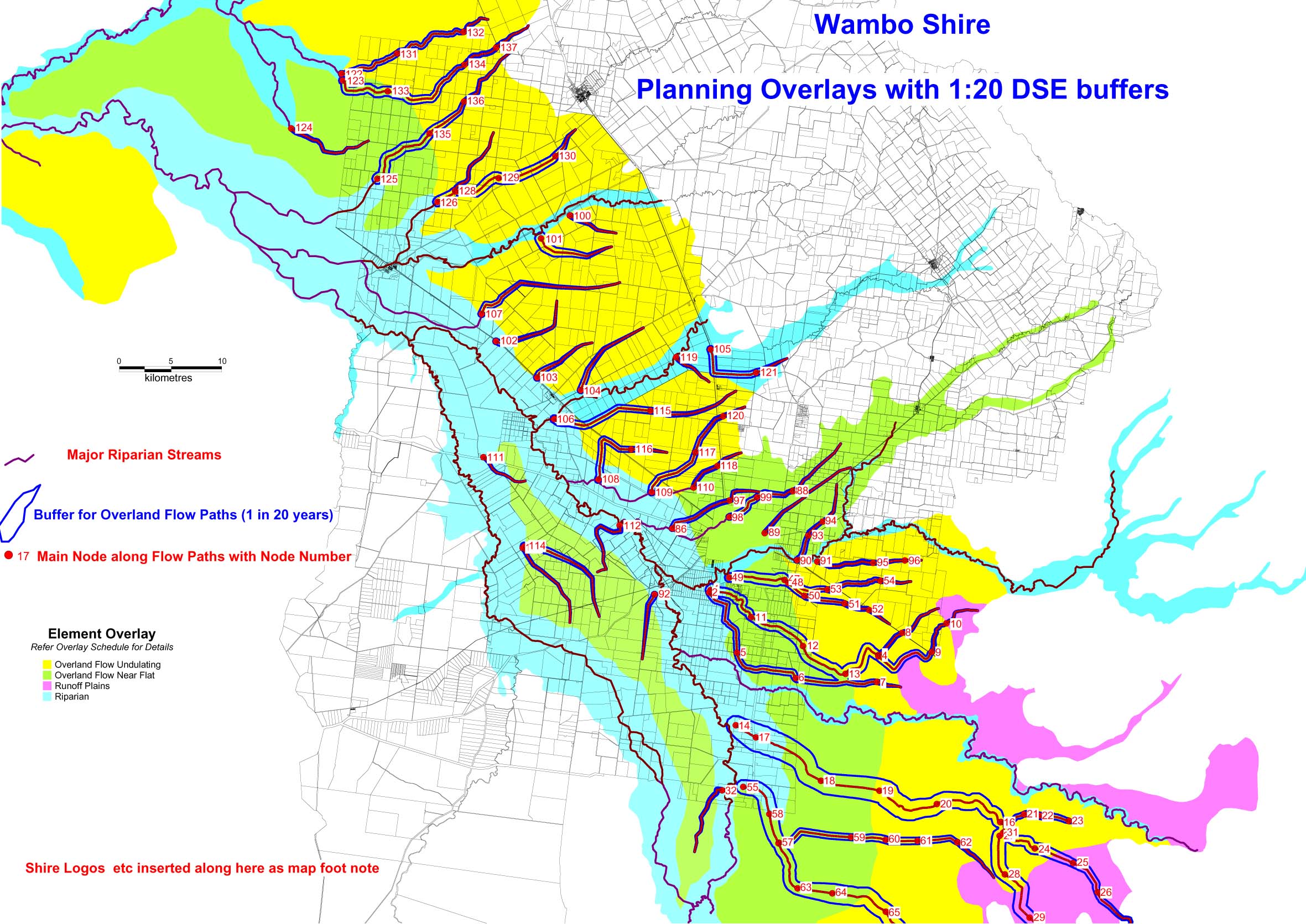
Landform elements, flow paths, main nodes and buffer strips
LRAM was commissioned by the Queensland Department of Local Government and Planning to develop a GIS process for modelling and mapping overland flow paths within the eastern Darling Downs and provide a subsequent mapping and database to relevant shires within the area.
Under the Integrated Planning Act, Local Authorities in Queensland are required to specify appropriate land uses and land management practices for all flood plain areas. Overland flow is a significant factor in water movement on the eastern Darling Downs and appropriate planning necessitates knowledge of the location and flood characteristics of these flow paths.
The project involved:
The Queensland Department of Natural Resources had collected detailed contour information and delineated current and natural flow paths for part of the study area. LRAM used this information, satellite imagery and less detailed topography information for the remaining areas to map all major flow paths within MapInfo GIS, locate nodal points and calculate cumulative overland flow down each path and buffer areas required around each flow path. Levels of assessment and consistency for material changes of land use along with performance criteria were then developed for the flow paths.
Landform elements, flow paths, main nodes and buffer strips