Burnett, Kolan, Baffle and Burrum Basins
Land
This study set the basis for a Water Quality Improvement Plan for
the Burnett, Kolan, Baffle and
The project used LANDSAT 5 Thematic Mapper
satellite imagery to provide coverage of the catchments during September 2004
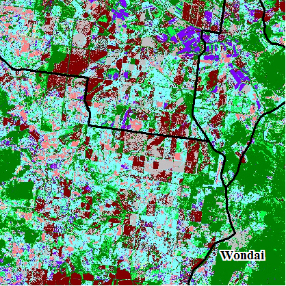
and May 2005. A supervised classification process was applied to the May 2005
imagery. This involved visually selecting sample areas (training regions)
representing the major types of land cover within the region. The
classification process then allocated pixels within the imagery into units
representing each training region. Extensive ground-truthing
was undertaken to verify training region selection, subsequent regional
classification and to correlate land degradation with cover.
Grassland areas were further subdivided into four cover classes
that closely reflect the Queensland DPI Pasture Condition Classes.
Rainforest,
scrub, open forest, woodlands and shrubby woodlands were not the focus of this
study and were combined with regrowth, forestry plantations and orchards into a
single mapping unit of standing timber.
|
|
|
|
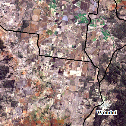
Enhanced colour
image |
Classified image |
The difference
in land cover between September 2004 and May 2005 was used to highlight
cropping areas, enabling crop stubble and pastures to be separated.
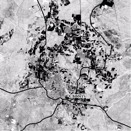
Highlighted cropping
areas
The land
cover classification was considered sufficiently accurate for